The 10th Yorkshire 3 Peaks Challenge
Report
The lovely weather and 413 participants attending made a very enjoyable and memorable day. Our team of volunteers contributed to the success, but the event is all about the walkers achieving their objective in pushing themselves to their own physical and mental limits. Encouraging each other to carry on shows our true character. There were tears of joy with aches and pains that will become fond memories in days to come. Photos with friends will be cherished for a long time.
133 completed all three peaks, 109 managed two peaks and 136 tackled one peak. Many participants were first timers and not seasoned hill walkers but took part to raise funds for SEWA UK charity No 1135425.
So far just over £11300 has been raised and some more funds in the next few weeks will add to the total.
“CTA” Charity Through Adventure has, over the years, given many people opportunities for training and encouragement to enjoy hill walking. Since the first walk in 2006, many of our participants have gone on to various high altitude treks, raising funds for various charities.
I want to thank all the participants over the years who have given immense satisfaction to all our volunteers. Thank you to all our volunteers for making time for others; your contribution is greatly appreciated by all participants.
Next year: Sunday 28 May 2017
Satish Shah
Team CTA and SEWA UK
Trek Photos


Trek Details
On Sunday 29th May 2016 (spring bank holiday weekend), we will be embarking on our 10th annual Yorkshire Three Peaks Challenge. This has been an increasingly popular event and we were joined by over 300 people last year.
This sponsored walk/trek covers 24.5 miles and goes across Pen-y-Ghent, Whernside and Ingleborough; a total climb of 5,000ft. There is a choice of walk(s) for all – choose to do 1,2 or all 3 peaks.
Please expand the sections below to view full details. If you prefer, you can automatically expand all the sections below by clicking here: Expand All / Collapse All
Registration & Fund Raising
Registration
- Please read our trek details and disclaimer before proceeding with registration.
- This year’s registration form can be found at the bottom of this page. The same form can be used for individual and group registrations.
- We ask that if possible, you fill in the form directly in the Word document, and email the completed copy back to us. This will make it much easier for us to process, but if for any reason you can’t do this, then we can still accept printed forms.
- Every participant should make an effort to raise funds. Sponsorship forms are available to download below.
- Please email forms to: ctay3peaks@gmail.com
Fees Payment & Own Donations
- Registration Fees:
- £7 – Working Person
- £5 – Others (including children, students, pensioners and unemployed)
- Please make payment of fees and donations online, directly to our BT MyDonate page, under the name of the main registrant. Please ensure Gift Aid is applied as appropriate.
https://mydonate.bt.com/fundraisers/y3peaks2016 - Please note that parents can donate their family members fees and children’s fees as part of their own fee for gift aid purposes.
- Please read our trek details and disclaimer before proceeding with registration.
- You can include a personal donation on top of paying your registration fees.
For example, to pay the £7 registration fee and an £8 donation, simply donate the total (£15) on the fundraising page. - When using MyDonate, we recommend you use a debit card to save on admin fees.
- Please remember to tick the tax relief box.
Fund Raising
- You can also create your OWN online fundraising page under our team page on ‘MyDonate.’
https://mydonate.bt.com/teams/ctamultievents - To create your own fundraising page as part of the CTA team:
- Register with MyDonate and look out for ‘Team’.
- Enter the charity as SEWA UK
- When asked if you are part of a team, click yes and then enter our reference number: 159782981
- You can see other fundraisers registered in the MyDonate team page above.
- All funds will go to SEWA UK
- If you have any queries, please get in touch on ctay3peaks@gmail.com
Trek Details
A rough guide to our event which we hold each year. The below is essential reading, including our disclaimer.
Background, Aims & Objectives
Background
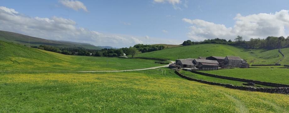
This sponsored walk/trek covers 24.5 miles and goes across Pen-y-Ghent, Whernside and Ingleborough: a total climb of 5,000ft. There is a choice of walk(s) for all – choose to do 1, 2 or all 3 peaks. The Yorkshire Dales is one of the most beautiful regions of the UK. Spend a weekend and make a visit to Malham Cove, a natural wonder. Participants have also walked in the Lake District, Snowdonia and the Scottish mountains.
All age groups and whole families can enjoy hill walking. You will have ample time to talk and make new friends. Physical and mental health benefits will come your way.
Yorkshire Three Peaks is a recognised challenge.
We have at the outset wanted newcomers and novices to try hill walking. Experienced and enthusiastic walkers should assist. Y3 Peaks is a challenge and walking 1, 2 or 3 peaks is not going to be easy for everyone. Most will experience minor aches, pains and tiredness. A few will find it hard and unpleasant and may not want to come back. Over the last few years many walkers have acquired leadership skills. Many more have gone on to foreign high altitude treks. Some of these people would otherwise not have considered this kind of recreation. It has made a positive difference to their attitude and life style. On the back of this challenge is the fund raising for our charities. The response has been amazing to say the least.
Time, Meeting Point & Directions
Time
You must arrive by 6.25am for registration & there will be a briefing at 6.50am.
You will be able to meet fellow walkers and our designated guides.
Walks/Treks will start at 7.00am sharp.
Meeting point & directions
Take the A65 to Skipton and B6479 Settle, to Horton in Ribblesdale (Post Code BD24 0HF).
You will pass the National Trust car park on left, over a narrow bridge, past the CROWN INN which is on right side and the road turns sharp left over a second narrow bridge. The car park/admin tent is on the right hand side on Station Road.
To contact us, please email us at ctay3peaks@gmail.com
Clothing, training, preparation / planning
You should be kitted out for a challenging trek. Weather conditions will change during the day. You could encounter hail, rain and mist making visibility difficulty. If it’s windy, it can get cold, and even colder on the summit. On the day, there will be hundreds of walkers.
Essential Kit List
On the day, you should be wearing:
- Hiking boots. (If you don’t have any proper hiking boots, and you are only doing 1 peak, then please wear thick soled trainers. ‘Converse’ or other flimsy shoes will not protect your feet enough or keep you warm and dry.)
- Hiking socks and thin liner socks.
- Hiking trousers or tracksuit bottoms. Do not wear jeans – if they get wet, they won’t dry off.
- A t-shirt, long sleeved top, or base layer. Avoid pure cotton clothes, as they can absorb sweat and won’t dry off.
- A jumper or fleece.
You should be carrying in your day rucksack:
- A waterproof jacket and waterproof trousers.
- Gloves and a warm hat.
- A thick jumper or fleece.
- A map. (Print from the link provided below, and carry in a plastic wallet to protect from rain.)
- Water, an isotonic drink, food and snacks.
- A few plasters and blister plasters.
- A torch and whistle.
Never under estimate the mountains and always prepare for the worst weather conditions. Wear or carry extra layers depending on the weather on the day.
- You will warm up when hiking, and cool off quickly when you stop for breaks or as the weather changes, so wear lots of layers that you can take on and off easily.
- You might get very wet or muddy, so keep spare clothes and shoes in the car.
- Each person should carry their own kit. Groups or families often set off together but finish at different times.
Watch our video guide on: What to wear
Watch our video guide on: What to pack
Disclaimer
Participation is at your own risk and by taking part you acknowledge and assume the risks inherent therein and further acknowledge that you are responsible for all your actions and fitness and health. You use any transportation arranged by the organisers at your own risk. The organisers are not responsible for the condition of the route and do not accept any responsibility for any injuries or illness.
Safety & Guidance
- Familiarise yourself with the official Countryside Code of England and Wales.
The Countryside Code:
– Respect other people.
– Consider the local community and other people enjoying the outdoors.
– Leave gates and property as you find them and follow paths.
– Protect the natural environment.
– Leave no trace of your visit and take your litter home.
– Enjoy the outdoors.
– Plan ahead and be prepared.
– Follow advice and local signs.
- Always walk in a group. Minimum size is 4, so if one person is injured, one person stays with them and two people can go together to find help.
- If you need assistance, you should keep walking ahead or back to the nearest checkpoint. You may have to wait for some time before help arrives.
- On this route, even if by chance you do get lost, you will always be near a farm, pub, house, main road, etc. so don’t panic. Bank holiday is a popular time, so there’ll be lots of other walkers in both directions.
- Remember, you can’t bring the city to the countryside. You might get muddy, wet, or lost for a while, but it’s all part of the experience of hiking.
- Experienced Marshals will make the final decision about continuing the route on the day, based on weather conditions etc.
You should:
- Read all our information and guidance.
- Do a web search on the Yorkshire Dales to obtain more background info.
- Do some training before the event.
- Acquire appropriate walking clothing and walking boots.
- Follow instructions from Guides and Marshals.
- You should be able to pass on your knowledge and experience to newcomers.
- You should be able to read and interpret Y3 Peaks map.
- You can come forward to act as a Guide or Assistant Guide.
- This will enhance your leadership and interpersonal skills.
- The event depends on experienced walkers acting as guides on the day.
You need to be:
- An experienced hill walker and know the Y3 peaks reasonably well.
- Kitted out well, so you can bear the severe weather and assist others.
- Reasonably fit to complete 1 or 2 or 3 peaks.
- Able to read and interpret Y3 Peaks map.
Your duty would be to:
- Lead, encourage and motivate other walkers to excel.
- To carry a torch and a whistle for use in low visibility/emergency situations.
- To act on any instructions from Marshals.
- To carry a mobile phone and contact numbers for use in emergency situations.
- Only in an extreme emergency you should abort the walk and assist in RESCUE.
You need to be:
- An experienced hill walker and know the Y3 peaks route and area.
- Kitted out for severe weather.
- Carry spare clothing for emergency use.
- Reasonable fit to complete 1 or 2 or 3 peaks as necessary
Your duty would be to:
- To monitor walkers at various check points.
- To walk the chosen 1 or 2 or 3 peaks as allocated to you and your team.
- To lease with guides to know what is happening on their section of walk.
- To assist stragglers and tail enders to next check point or base.
- To make decisions on changing weather conditions or circumstances and pass on instructions to walkers.
- To provide assistance and take part in RESCUE if necessary.
- To carry a mobile phone and contact numbers for use in emergency situations.
- You should wear warm and waterproof clothing.
- You should carry appropriate warm drinks and food.
- It can be a long day so be prepared.
- Our car parking volunteers will direct you to parking area.
- Our volunteers will at the service tents dealing with registrations, collections of pre-registered identity cards etc.
Service Points & Retiring Early
- Two service points where our volunteers will serve – water, fruits & chocolates.
- First aid will be available.
- Marshals will be at hand to give advice.
- If you are unable to carry on further, speak to the volunteers who arrange transport back to base for you. You may have to wait until the vehicle is full and we may request a small donation towards cost of the event.
Choice of walks for all
Walks for 2016 to be confirmed – please note that the below are draft.
1) The three peaks 24.50 miles: Grade: Strenuous / Very Hard
Pen-y-Ghent ,Whernside and Ingleborough total climb 5,000ft
Average fitness – walk time approx. 12 Hours, fast group 9 hours.
Training – hill walking, running, gym, yoga etc
Transport to base will only be provided in an emergency, such as in the case of injuries. This will be available from:
– Service point at T Junction/ Station Inn and,
– Service point at Base of Whernside / The Old Hill Inn
Our Marshals and guides will decide on a need basis, and we request a £2 contribution to cover fuel costs.
TIME LIMIT: 11.00 AM – our marshals will review time limits depending on the weather conditions. Beyond this time limit, you will be advised to do only two peaks.
2) Two Peaks walk Grade: Moderate to Hard
Pen-y-Ghent and Ingleborough: 18 miles total climb 3,300ft
Pen-y-Ghent to Station Inn/Viaduct with the 3 peakers
Our Marshals will be at hand to give advice and directions.
- At the T Junction, walk on the main road B6255 past Station Inn on the right, towards The Old Hill Inn.
- The Road distance is 1.55 miles and at slow pace will take 30 to 35 minutes.
- Please walk in single line on the right-hand side of the road so that you can see the cars coming.
At the start for Ingleborough there is a open grass area where you can rest and have lunch. Please only proceed with our guides.
You will meet with the 3 Peakers and proceed to the summit of Ingleborough, and then back to Base.
Training – hill walking, town walking, running, gym & yoga etc
Only emergency transport will be available at the base of Whernside.
We request a £2 contribution to cover fuel costs.
3) One Peak – Pen-y-Ghent Grade: moderate – short and steep
Long 10 miles – return to base from Marshall Point 5
Short 6.5 miles – return to base from Marshall Point 4.
Starts just after the main group.
Pen-y-Ghent and going right up to High Wirkwith and back to base.
Emergency transport will only be provided due to injury and we request a £2 contribution to cover fuel costs.
We will have guides and pace will be slow to allow you time to enjoy this walk, be able to stop and see both the Hunt Pot and Hull Pot as time permits.
There is an option to shorten the route on a need-by-need basis. Our guides will encourage and advice as necessary.
Please keep the dales clean. Bring waste back to base and dispose properly.
Search Google for “Yorkshire three peaks” for further details. There are lots of places to visit before and after.
Search Google for “Yorkshire three peaks” for further details.
Please continue to check this page for updated details.
To contact us, please email us at ctay3peaks@gmail.com
Forms & Maps
- Map (8MB)
- Registration Form (Word Doc)
- Fundraising Form (Word Doc)